ASCRead
Signatures
ASCRead(VARCHAR path);
ASCRead(VARCHAR path, BOOLEAN deleteTable);

ASCRead(VARCHAR path, VARCHAR myTable);
ASCRead(VARCHAR path, VARCHAR myTable, BOOLEAN deleteTable);

ASCRead(VARCHAR path, INTEGER type);
ASCRead(VARCHAR path, INTEGER type, BOOLEAN deleteTable);

ASCRead(VARCHAR path, VARCHAR myTable, INTEGER type);
ASCRead(VARCHAR path, VARCHAR myTable, INTEGER type, BOOLEAN deleteTable);

ASCRead(VARCHAR path, VARCHAR myTable, GEOMETRY geomFilter,
        INTEGER downScaleInt, BOOLEAN asPolygons);
ASCRead(VARCHAR path, VARCHAR myTable, GEOMETRY geomFilter,
        INTEGER downScaleInt, BOOLEAN asPolygons, BOOLEAN deleteTable);
Description
Import Esri ASCII Raster file as POINT or POLYGON geometries.
Pixels are converted into PointZ (or PolygonZ) geometry with Z as the pixel value (stored as DOUBLE).
Where:
path: adress of the.ascfile. This file may be zipped in a.gzfile (in this case, theASCReaddriver will unzip on the fly the.gzfile),myTable: name of the output table,type: indicates whether thezdata type will be casted to INTEGER (1) or left as DOUBLE (2- default value),geomFilter: extract only pixels that intersects the provided geometry envelope (nullor empty argument to disable filter),downScaleInt: a coefficient used for exporting less cells (1all cells,2for size / 2, …),asPolygons: iftrue, pixels are converted into polygons (default value =falsereturn points),deleteTable: iftrueand tabletableNamealready exists in the database, then tabletableNamewill be removed / replaced by the new one. Else (nodeleteTableparameter ordeleteTableequal tofalse), throw an exception if thetableNamealready exist.
Examples
We assume that we have the following .asc file, named dem and placed here: /home/user/.
ncols        4
nrows        4
xllcorner    10
yllcorner    10
cellsize     5.0
NODATA_value  -9999
 28 27 26 25
 27 25 24 23
 26 23 20 19
 25 20 18 17
1. Using the path
CALL ASCREAD('/home/user/dem.asc');
Returns the table dem, with the following values:
PK |
THE_GEOM |
Z |
|---|---|---|
1 |
POINT Z (12.5 27.5 28) |
28.0 |
2 |
POINT Z (17.5 27.5 27) |
27.0 |
3 |
POINT Z (22.5 27.5 26) |
26.0 |
4 |
POINT Z (27.5 27.5 25) |
25.0 |
5 |
POINT Z (12.5 22.5 27) |
27.0 |
6 |
POINT Z (17.5 22.5 25) |
25.0 |
7 |
POINT Z (22.5 22.5 24) |
24.0 |
8 |
POINT Z (27.5 22.5 23) |
23.0 |
9 |
POINT Z (12.5 17.5 26) |
26.0 |
10 |
POINT Z (17.5 17.5 23) |
23.0 |
11 |
POINT Z (22.5 17.5 20) |
20.0 |
12 |
POINT Z (27.5 17.5 19) |
19.0 |
13 |
POINT Z (12.5 12.5 25) |
25.0 |
14 |
POINT Z (17.5 12.5 20) |
20.0 |
15 |
POINT Z (22.5 12.5 18) |
18.0 |
16 |
POINT Z (27.5 12.5 17) |
17.0 |
Remark: If the dem.asc has been zipped into a .gz file, execute the following instruction:
CALL ASCREAD('/home/user/dem.asc.gz');
In this case, since the myTable parameter has not been specified, the resuling table will be named DEM_ASC.
2. Using myTable
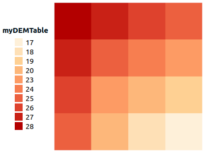
CALL ASCREAD('/home/user/dem.asc', 'myDEMTable');
Returns the table myDEMTable (same as dem table)
PK |
THE_GEOM |
Z |
|---|---|---|
1 |
POINT Z (12.5 27.5 28) |
28.0 |
2 |
POINT Z (17.5 27.5 27) |
27.0 |
… |
… |
… |
3. Using type
Here we want to convert Z value into INTEGER
CALL ASCREAD('/home/user/dem.asc', 1);
Returns the table myDEMTable
PK |
THE_GEOM |
Z |
|---|---|---|
1 |
POINT Z (12.5 27.5 28) |
28 |
2 |
POINT Z (17.5 27.5 27) |
27 |
… |
… |
… |
4. Using geomFilter
Here, we want to keep only POINTs that intersect this geometry: POLYGON((15 15, 15 25, 25 25, 25 15, 15 15))
CALL ASCREAD(
  '/home/user/dem.asc',
  'myDEMTable',
  ST_GeomFromText('POLYGON((15 15, 15 25, 25 25, 25 15, 15 15))'),
  1, false);
Returns the table myDEMTable, with the following values:
PK |
THE_GEOM |
Z |
|---|---|---|
1 |
POINT Z (17.5 22.5 25) |
25.0 |
2 |
POINT Z (22.5 22.5 24) |
24.0 |
3 |
POINT Z (27.5 22.5 23) |
23.0 |
4 |
POINT Z (17.5 17.5 23) |
23.0 |
5 |
POINT Z (22.5 17.5 20) |
20.0 |
6 |
POINT Z (27.5 17.5 19) |
19.0 |
7 |
POINT Z (17.5 12.5 20) |
20.0 |
8 |
POINT Z (22.5 12.5 18) |
18.0 |
9 |
POINT Z (27.5 12.5 17) |
17.0 |
5. Using downScaleInt
Here we want to divide the matrix size by 2
CALL ASCREAD('/home/user/dem.asc', 'myDEMTable', null, 2, false);
Returns the table myDEMTable, with the following values:
PK |
THE_GEOM |
Z |
|---|---|---|
1 |
POINT Z (12.5 27.5 28) |
28.0 |
2 |
POINT Z (22.5 27.5 26) |
26.0 |
3 |
POINT Z (12.5 17.5 26) |
26.0 |
4 |
POINT Z (22.5 17.5 20) |
20.0 |
6. Using asPolygons
Here we want to have a resulting POLYGON layer.
CALL ASCREAD('/home/user/dem.asc', 'myDEMTable', null, 1, true);
Returns the table myDEMTable, with the following values:
PK |
THE_GEOM |
Z |
|---|---|---|
1 |
POLYGON Z ((10 30 28, 10 25 28, 15 25 28, 15 30 28, 10 30 28)) |
28.0 |
2 |
POLYGON Z ((15 30 27, 15 25 27, 20 25 27, 20 30 27, 15 30 27)) |
27.0 |
3 |
POLYGON Z ((20 30 26, 20 25 26, 25 25 26, 25 30 26, 20 30 26)) |
26.0 |
4 |
POLYGON Z ((25 30 25, 25 25 25, 30 25 25, 30 30 25, 25 30 25)) |
25.0 |
5 |
POLYGON Z ((10 25 27, 10 20 27, 15 20 27, 15 25 27, 10 25 27)) |
27.0 |
6 |
POLYGON Z ((15 25 25, 15 20 25, 20 20 25, 20 25 25, 15 25 25)) |
25.0 |
7 |
POLYGON Z ((20 25 24, 20 20 24, 25 20 24, 25 25 24, 20 25 24)) |
24.0 |
8 |
POLYGON Z ((25 25 23, 25 20 23, 30 20 23, 30 25 23, 25 25 23)) |
23.0 |
9 |
POLYGON Z ((10 20 26, 10 15 26, 15 15 26, 15 20 26, 10 20 26)) |
26.0 |
10 |
POLYGON Z ((15 20 23, 15 15 23, 20 15 23, 20 20 23, 15 20 23)) |
23.0 |
11 |
POLYGON Z ((20 20 20, 20 15 20, 25 15 20, 25 20 20, 20 20 20)) |
20.0 |
12 |
POLYGON Z ((25 20 19, 25 15 19, 30 15 19, 30 20 19, 25 20 19)) |
19.0 |
13 |
POLYGON Z ((10 15 25, 10 10 25, 15 10 25, 15 15 25, 10 15 25)) |
25.0 |
14 |
POLYGON Z ((15 15 20, 15 10 20, 20 10 20, 20 15 20, 15 15 20)) |
20.0 |
15 |
POLYGON Z ((20 15 18, 20 10 18, 25 10 18, 25 15 18, 20 15 18)) |
18.0 |
16 |
POLYGON Z ((25 15 17, 25 10 17, 30 10 17, 30 15 17, 25 15 17)) |
17.0 |